en daarna verder door naar het Hellend vlak van Ronquière.
Was best wel indrukwekkend, onze Wout (8j) was er nog nooit geweest.
We hebben ons de weg laten wijzen door onze goede vriend Garmin
met de routeerbare topokaart, echt wel "toppie"
Hij heeft wel regelmatig moeten herberekenen voor paden waar wij niet door konden of mochten.
in totaal 142 Km
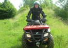
De foto's zeggen genoeg,
Genieten en nog eens genieten
![Afbeelding](http://img30.imageshack.us/img30/2503/55221696.th.jpg)
![Afbeelding](http://img30.imageshack.us/img30/61/74862851.th.jpg)
![Afbeelding](http://img30.imageshack.us/img30/9395/55051685.th.jpg)
![Afbeelding](http://img7.imageshack.us/img7/690/46726829.th.jpg)
![Afbeelding](http://img7.imageshack.us/img7/8615/34266207.th.jpg)
![Afbeelding](http://img3.imageshack.us/img3/1041/84775339.th.jpg)
![Afbeelding](http://img269.imageshack.us/img269/1160/92461778.th.jpg)
![Afbeelding](http://img269.imageshack.us/img269/3334/95508032.th.jpg)
![Afbeelding](http://img269.imageshack.us/img269/2996/14410110.th.jpg)
![Afbeelding](http://img269.imageshack.us/img269/7388/24497028.th.jpg)
![Afbeelding](http://img269.imageshack.us/img269/8531/44128260.th.jpg)
![Afbeelding](http://img3.imageshack.us/img3/235/14403195.th.jpg)
![Afbeelding](http://img3.imageshack.us/img3/1151/81229513.th.jpg)
![Afbeelding](http://img3.imageshack.us/img3/6311/79391764.th.jpg)
![Afbeelding](http://img3.imageshack.us/img3/126/13267852.th.jpg)
![Afbeelding](http://img3.imageshack.us/img3/3198/83578237.th.jpg)
![Afbeelding](http://img3.imageshack.us/img3/6646/22095035.th.jpg)
![Afbeelding](http://img3.imageshack.us/img3/2449/70312330.th.jpg)
![Afbeelding](http://img3.imageshack.us/img3/5136/91443115.th.jpg)
![Afbeelding](http://img3.imageshack.us/img3/8185/85026317.th.jpg)
![Afbeelding](http://img3.imageshack.us/img3/9415/19946431.th.jpg)
![Afbeelding](http://img4.imageshack.us/img4/282/34753376.th.jpg)
![Afbeelding](http://img4.imageshack.us/img4/7302/39458986.th.jpg)
![Afbeelding](http://img4.imageshack.us/img4/508/19201508.th.jpg)